The site of Balregan, Co. Louth comprised a double-ditched enclosure situated on a low knoll at the confluence of two rivers, with extensive views in all directions. The site was found during road construction and was excavated by Brian O’Donnachada for IAC Archaeology. Full excavation results are published in Around the Bay of Dundalk: archaeological investigations along the route of the M1 Dundalk Western Bypass.

Although the double-ditched enclosure, with the remnants of a stone bank sitting between the two banks, was the most substantial remains at Balregan, evidence of an earlier phase of activity was sealed beneath the stone bank. This comprised a number of stakeholes, pits, spreads and a firepit; these did not form an obvious pattern, although the stakeholes may represent the remains of a light structure. The artefacts associated with these features included 262 sherds of Impressed Wares (from at least 26 vessels, and possibly as many as 30); this style of pottery usually dates to 3600–3300 BC. The Balregan assemblage included broad rimmed bowls, bi-partite shouldered bowls, bi-partite bowls and globular bowls. It is an exceptional assemblage of this type of pottery in terms of the size and quality of many of the vessels, with some of the vessel rims measuring more than 0.4m in diameter. The pots may have been put on display and used for ceremonial purposes (most comparative assemblages are from contexts associated with rituals, such as megalithic tombs). There were no traces of carbonized food residues on this pottery but analysis of absorbed organic residues from the sherds indicates that they were used to store or process dairy products, such as milk (Smyth and Evershed, 2015).
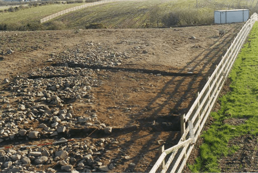
Only a small portion of the eastern side of the enclosure was excavated, as this is the only part that fell within the route of the new road construction; it is, however, possible that the enclosure formed a full circuit around the top of the natural knoll on which it was built.
A section of the outer ditch (c. 44m long) was excavated, uncovering a v- to u-shaped in profile, with a maximum width of 3.5m and a maximum depth of 1.4m. The excavated sediments shows a sequence of primary silting, slumping from the bank, and charcoal-rich material in the upper fills, which also contained unidentifiable burnt bone and sherds of Grooved Ware (which is usually dated to 2850–2450 cal BC). The excavated remains of the outer ditch suggest that if it was a complete circuit, the external diameter would have been c. 82m. On the inside edge of the outer ditch, a c. 32m long portion of the bank survived as a loose stone foundation formed by river-rolled stones (presumably sourced from the nearby rivers). The inner ditch had a u-shaped profile, it was between 2m and 4m wide, with a maximum depth of 1.4m. Sherds of Impressed Ware (interpreted as coming from the earlier phase of activity, which was disturbed when the ditch was dug) and lithics were recovered from the lower layers of silting within the ditch, and these were sealed by layers of intensely burnt material that were interpreted as dumped material, rather than in situ burning. The upper layers contained sherds of Grooved Ware pottery and the nature of these layers suggested that they accumulated as a result of gradual slumping and infilling of the ditch.
In the southern portion of the trench, a 8m wide gap in both the inner and outer ditch corresponded with the end of the stone bank foundation, suggesting this was an entrance to the enclosure, facing to the south east. A large irregular pit located in the entrance, following the line of the outer ditch, had a smaller stone-lined pit cut into its base, and contained sherds from a single Grooved Ware vessel. A small pit located within the enclosure (close to the inner ditch and just to the north of the entrance) contained small fragments of cremated human remains, representing the partial remains of an adult skeleton, possibly from a young adult female.
Later activity at the site included a firepit cut into the upper fills of the outer ditch. Charcoal from this deposit was radiocarbon dated to around the 4th and 3rd centuries BC.
Further reading
Delaney, S., Bayley, D. and McKeon, J. (2020) Around the Bay of Dundalk: archaeological investigations along the route of the M1 Dundalk Western Bypass. Dublin: Transport Infrastructure Ireland (TII Heritage Series, 10).
Ó Donnchadha, B. & Grogan, E. (2010). Archaeological excavation report, 03E0157 Site 116 Balregan 1 and 2, County Louth. [Unpublished excavation report for IAC Archaeology]. IAC Archaeology and Transport Infrastructure Ireland; Digital Repository of Ireland. https://repository.dri.ie/catalog/tm711893r
2003:1221 – Balregan, Louth – https://excavations.ie/report/2003/Louth/0010260/
Smyth, J. and Evershed, R. P. (2015) ‘The molecules of meals: new insight into Neolithic foodways’, Proceedings of the Royal Irish Academy. Section C: Archaeology, Celtic Studies, History, Linguistics, Literature, 115C, pp. 27–46. doi: 10.3318/priac.2015.115.07. (Fig. 1, p.33 shows chromatograms of the lipid component characteristics of a sherd of Impressed Ware from Balregan 1 (03E0157:37:36).)
